San Francisco

A city named for Saint Francis, read in layers from a 1776 mission to a modern cathedral, and now walkable end to end.

Catholic San Francisco is not a single quarter. It is four or five distinct layers, laid down between 1776 and 1970, that a visitor can now read on foot because the Camino de San Francisco was inaugurated in 2026 to connect them.

Region
North America
Suggested time
One day, or two with the Camino
Places
4
Saints
5
Walk the Camino de San Francisco
2

How long you have

One day reads the layers; two days walks between them

Almost every Catholic city in the Americas has a founding mission and a later cathedral. Few have them this legible, this close together, or this honestly told. The mission that gave the city its name still stands, its adobe chapel intact since 1791, with some five thousand Ohlone, Miwok and other First Californians buried beside it. Two miles north, a Gold Rush parish became a national shrine to the saint the city is named for. Between them are an Italian parish still praying in three languages and a cathedral that argues, in concrete, about what a modern Catholic building should be. Walking between them is now a recognised pilgrimage.

The Terrain

Three miles of hills, from the mission to the bridge

Catholic San Francisco runs roughly southwest to northeast across the city's hills. The mission sits low in the Mission District, sheltered from the fog that the western half of the city lives under. Cathedral Hill rises in the middle. North Beach lies at the foot of Telegraph Hill in the northeast, and the Presidio and the Golden Gate close the city at its northwest corner. The distances are short, but the climbs between them are real, and a visitor who plans this as a flat two-mile walk will be corrected by the second hill.

The Golden Gate Bridge seen across the water from the Crissy Field shore, with the Marin Headlands behind it under low fog.
The northwest corner of the city, where pilgrims walking the Camino arrive on foot.

The Mission

The low, sunny district around 16th and Dolores, where the mission was founded in 1776 beside the Arroyo de los Dolores. The Old Mission chapel, the basilica beside it, and the only cemetery left inside the city limits all stand on one corner.

On the ground The southern end of Catholic San Francisco and the end of the Camino. Reachable by Muni from Cathedral Hill, or a downhill walk of about two miles.
Cathedral Hill

The rise around Gough and Geary, where the archdiocese rebuilt its cathedral after the 1962 fire. Open plaza, long views, and a building that looks like nothing else in the city.

On the ground Between North Beach and the Mission, and the natural midpoint of a one-day visit.

North Beach

The old Italian quarter at the foot of Telegraph Hill, now mixed Italian, Chinese and Latin American. Saints Peter and Paul faces Washington Square; the National Shrine is a few streets away on Vallejo.

On the ground Two churches within a few minutes' walk of each other. This is the densest Catholic ground in the city.

The Presidio and the Golden Gate

The northwest corner: open headland, the Main Post Chapel of 1931, Crissy Field where John Paul II arrived in 1987, and the bridge itself. Not a quarter of churches, but the ground the Camino crosses on its way in.

On the ground The pilgrim's entrance to the city on foot. About four miles from the bridge to North Beach.

Sacred geography

Choose a way into the city

The mission foundation

Franciscan devotion

Immigrant parishes and the modern Church

The four places

A mission, a national shrine, an immigrant parish, and a modern cathedral

Four canonical places, each from a different century of Catholic San Francisco. The Camino connects them, but each stands on its own.

mission church and basilica

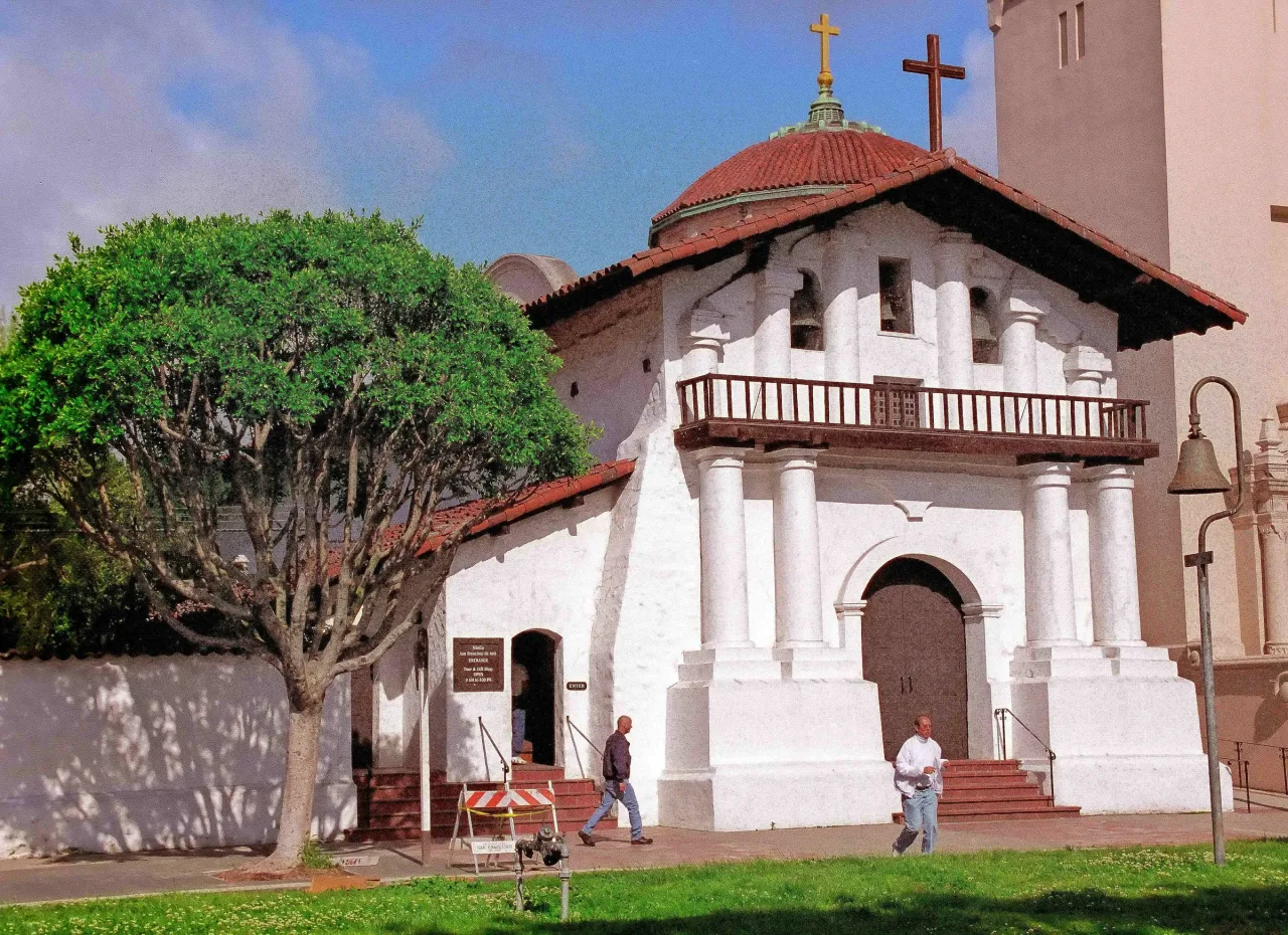
Mission San Francisco de Asís

THE MISSION

The mission that named the city. Its adobe chapel of 1791 is the oldest intact building in San Francisco, and some five thousand Ohlone, Miwok and other First Californians are buried beside it.

national shrine

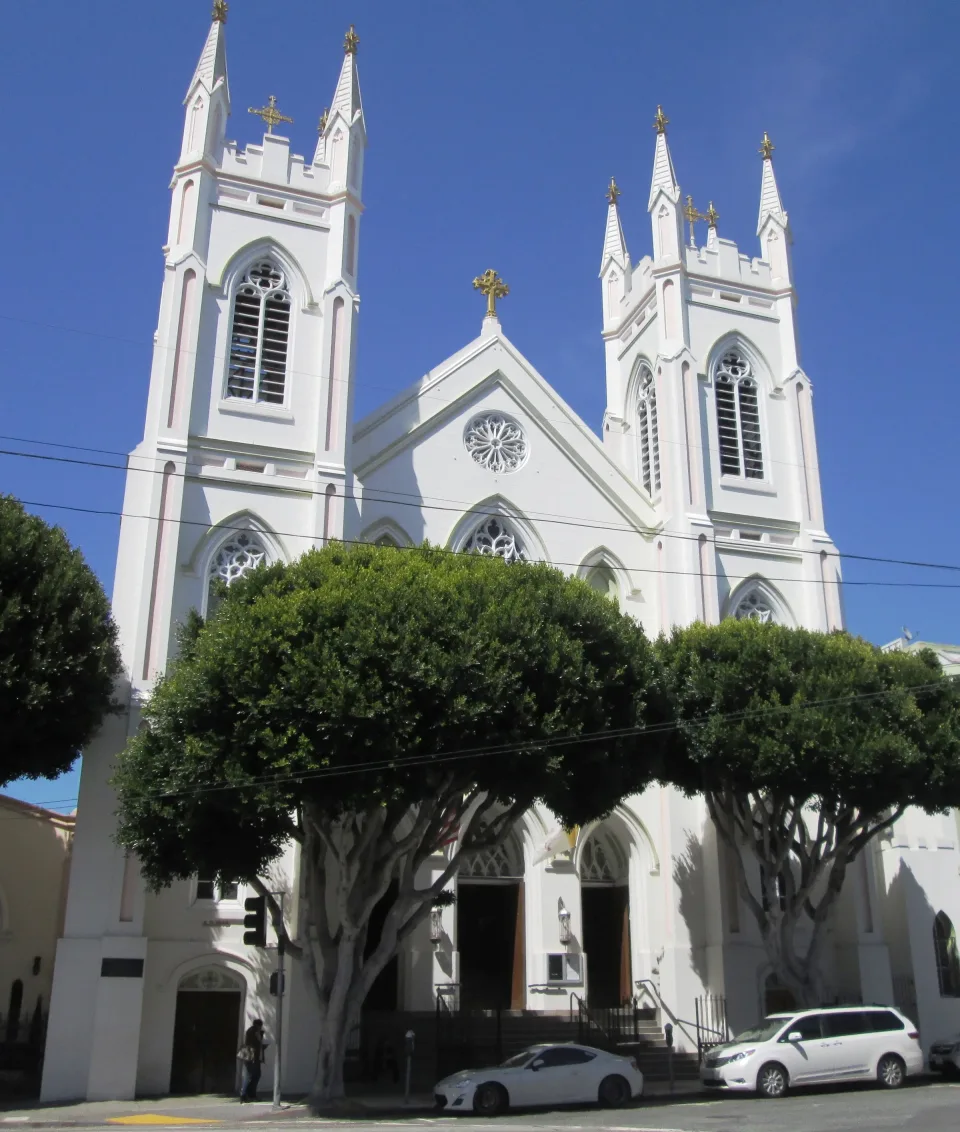
National Shrine of St. Francis of Assisi

NORTH BEACH

A Gold Rush parish rebuilt inside its 1860 walls, now a national shrine served by Capuchin friars, holding relics the shrine identifies as those of Francis, Clare and Anthony.

cathedral

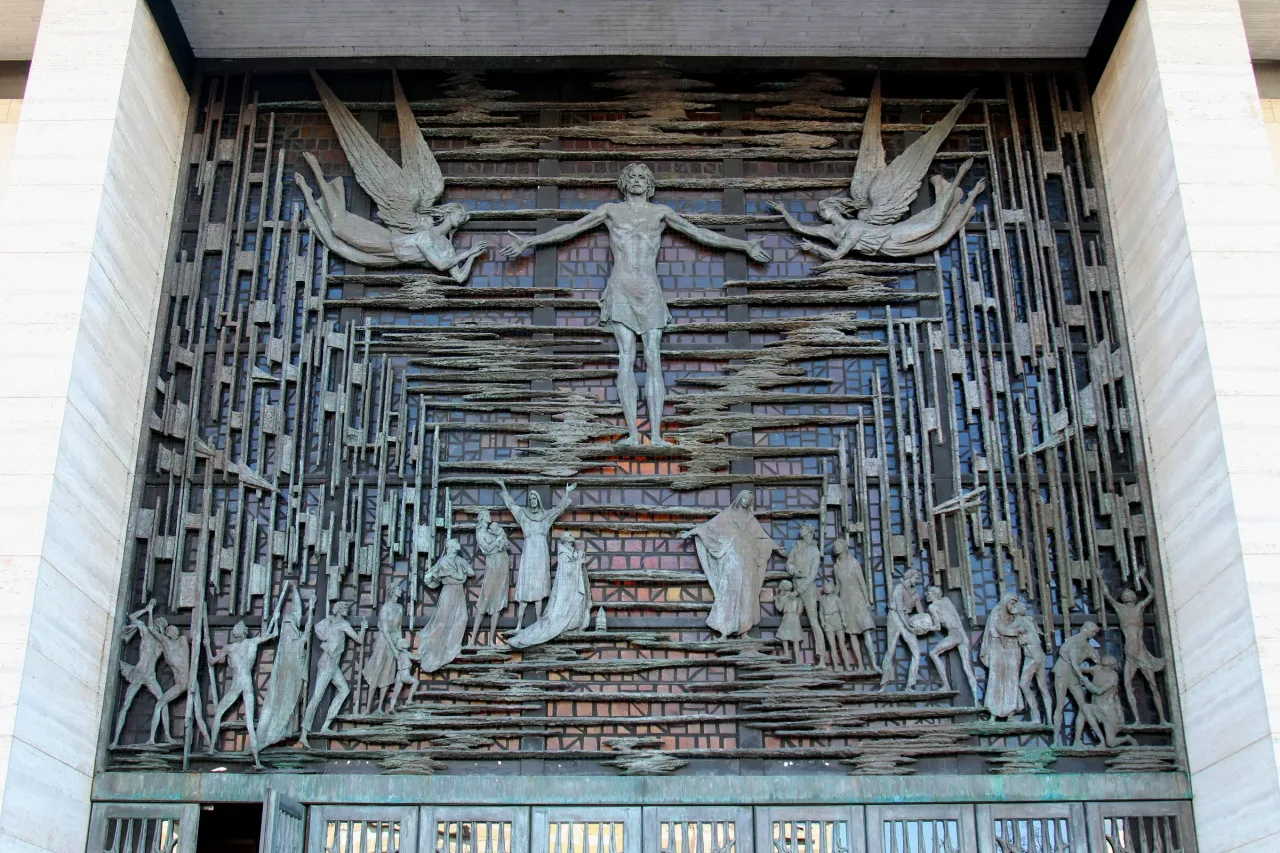
Cathedral of St. Mary of the Assumption

CATHEDRAL HILL

The mother church of the archdiocese, raised after fire destroyed its predecessor in 1962 and blessed in 1971. The most deliberately modern building on any Catholic route in California.

parish church

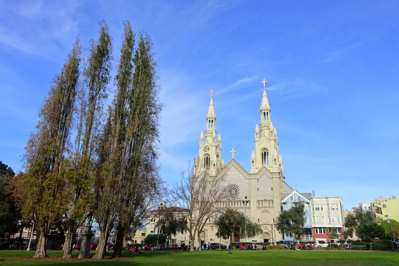
Saints Peter and Paul Church

NORTH BEACH

The twin-spired Salesian church on Washington Square, founded for Italian immigrants in 1884 and now praying in English, Italian and Cantonese.

Sacred map

San Francisco Sacred Places Map

4 Essential Places shown.

Select a marker to visit or save that place. The list above stays complete on its own.

Suggested pilgrimages

Paths we've walked, ready to make yours.

2 in San Francisco

Suggested order. Verify opening hours, transit, and walking conditions before you go.

How My Journey works →

Each entry named and sourced

Tombs, relics & sacred objects

There is no tomb of a saint in San Francisco. What the city holds are Franciscan relics at the national shrine, and a burial ground that matters more than any reliquary here.

Relics of Saints Francis, Clare and Anthony

La Porziuncola Nuova

The Old Mission chapel and its cemetery

  • Relics of Saints Francis, Clare and Anthony
  • La Porziuncola Nuova
  • The Old Mission chapel and its cemetery

Plan the days

Let the Porziuncola's short hours set the shape of the day

Plan 1

Mission Dolores alone

Go to the Old Mission, sit in the 1791 chapel, look up at the Ohlone ceiling, and walk the cemetery. Do not try to add North Beach to the same short window.

  1. Mission San Francisco de Asís

Practical, not booking

Before you go

The Porziuncola sets the clock

The small chapel at the National Shrine keeps far shorter hours than the church around it. Build the day around those hours rather than hoping.

The hills are the distance

North Beach to Cathedral Hill to the Mission is about three miles on the map and considerably more in the legs. Muni is not a defeat.

The mission gift shop is a separate thing

Camino certificates and the pilgrim passport are handled at gift shops, which do not keep the same hours as the churches they belong to.

Fog is a planning fact

Summer mornings on the western and northern edges of the city can be cold and grey while the Mission is in sun. Dress for both.

Photo credits
  1. San Francisco; San Francisco city hero. Supercarwaar, CC BY-SA 4.0, via Wikimedia Commons. Source. CC BY-SA 4.0.
  2. Mission San Francisco de Asís. Mission Dolores (1165072819). David Ohmer, CC BY 2.0, via Wikimedia Commons. Source. CC BY 2.0.
  3. National Shrine of St. Francis of Assisi. Beyond My Ken, CC BY-SA 4.0, via Wikimedia Commons. Source. CC BY-SA 4.0.
  4. Cathedral of St. Mary of the Assumption. Cathedral of Saint Mary of the Assumption (24325315983). Prayitno, CC BY 2.0, via Wikimedia Commons. Source. CC BY 2.0.
  5. Saints Peter and Paul Church. Daderot, CC0, via Wikimedia Commons. Source. CC0.
  6. The northwest corner of the city, where pilgrims walking the Camino arrive on foot.; Three miles of hills, from the mission to the bridge. Yair Haklai, CC BY-SA 4.0, via Wikimedia Commons. Source. CC BY-SA 4.0.